What You Need To Know
Davao City is a highly urbanized city on Mindanao, Philippines. As of the 2015 census, it had a population of 1,632,991 people, making it the third-most-populous city in the Philippines and the most populous in Mindanao. It is the center of Metro Davao, the third most populous metropolitan area in the Philippines (as of 2015 census with a population of 2.5 million, after Metro Manila’s 12.8 million and Metro Cebu’s 2.8 million). With a total land area of 2,444 square kilometers, the city is the largest in the country in terms of land area. The city serves as the main TRADE, commerce, and industry hub of Mindanao and the regional center of Davao Region. Davao is home to Mount Apo, the highest mountain in the Philippines. Davao is also known as the “Durian Capital” of the Philippines. For geographical and statistical purposes, Davao City is grouped with the province of Davao del Sur but is governed independently from it. The city is divided into three congressional districts, which are subdivided into 11 administrative districts with a total of 182 barangays. Davao City is constantly described by its residents and the national media as arguably among one of the safest cities in the Philippines, however this has been met with criticism.
Area: 2,444 km²
Population: Estimate 1,632,991
Currency
-
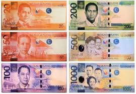
The Philippine Peso is the currency of Philippines. Our currency rankings show that the most popular Philippines Peso exchange rate is the PHP to USD rate.
Economy
Davao is part of the East Asian Growth Area, a regional economic-cooperation initiative in Southeast Asia. In 2011, Davao City ranked 87th among the Asia’s fastest-growing cities by the City Mayors Foundation, based in London and Freiburg, Germany. According to the foundation, the city has a projected average annual growth of 2.53 percent over a 15-year period; Davao was the only Philippine city to reach the top 100. As the largest economy outside Metro Manila, the city also serves as the largest local economy in southern Philippines.
Ethnicity
Language
Health
-
Healthcare in the Philippines are varying from private, public, to barangay health centers(many rural municipalities). Most of the national burden of health care is taken up by private health providers. There are 31 hospitals and tertiary centers in the city like Davao Doctors Hospital, San Pedro Hospital, Brokenshire Memorial Hospital, Ricardo Limso Medical Center, Davao Medical School Foundation Hospital (DMSF Hospital), Metro Davao Medical and Research Center, Davao Adventist Hospital, MMG Hospital, CHDC Hospital and the Southern Philippines Medical Center.
Religion
Topography
Davao City’s land, totaling about 2,443.61 square kilometres (943.48 sq mi), is hilly in the west (the Marilog district) and slopes down to the southeastern shore. Mount Apo, the highest peak in the Philippines, is located at the city’s southwestern tip. Mount Apo National Park (the mountain and its surrounding vicinity), was inaugurated by President Manuel Quezon (in Proclamation 59 of May 8, 1936) to protect the flora and fauna of the surrounding mountain range. The Davao River is the city’s primary drainage channel. Draining an area of over 1,700 km2 (660 sq mi), the 160-kilometre (99 mi) river begins in the town of San Fernando, Bukidnon. The mouth of the river is located at Barangay Bucana at Talomo District.
Transport
Land
Popular modes of public transportation in the city are multicabs, jeepneys, tricycles, buses and taxis. Multicabs and jeepneys ply 82 designated passenger-vehicle routes around the clock. Tricycles ply routes beyond the main streets of the city. Taxis have several routes in and around Davao City. In mountainous areas, the habal-habal passenger motorcycle is the main mode of transportation.
Sea
Davao is connected to Manila by roll-on/roll-off inter-island ferries. The city is served by domestic passenger ferries at Sasa International Seaport and Santa Ana Wharf, the international seaports of the Port of Davao, the busiest port in Mindanao. The port is capable of servicing inter-island and international shipments. It is located in Davao Gulf and has two approaches, one at Pakiputan Strait between Davao and western Samal Island.
Air
Davao City has direct flights to major Philippine cities and international destinations like Singapore, Xiamen, Jeddah and Medina. Located north from the city center, Francisco Bangoy International Airport is the major airport serving the city and the region. It is the busiest airport in Mindanao and the third-busiest in the country. On November 12, 2007, Cebu Pacificannounced that the airport would be its third hub.
Weather
Davao has a tropical rainforest climate (Köppen climate classification Af), with little seasonal variation in temperature. Average monthly temperatures are always above 26 °C (78.8 °F), and average monthly rainfall is above 77 millimetres (3.03 in). This gives the city a tropical climate, without a true dry season; while there is significant rainfall in winter, the largest rainfall occurs during the summer months (see climate chart, below).


